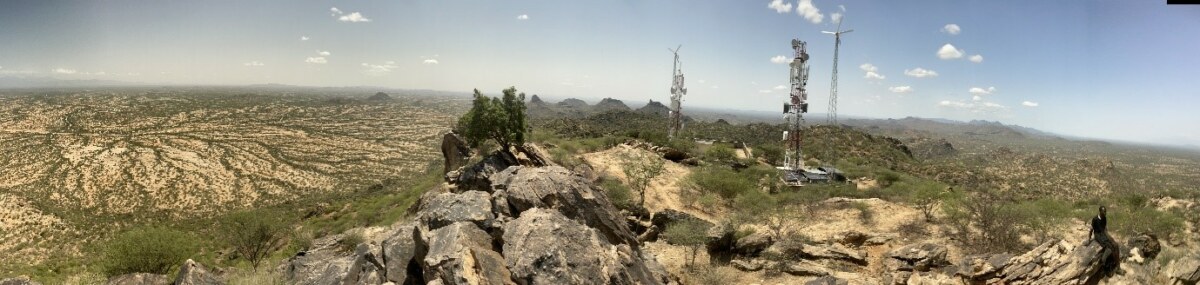
Mountains south of Lokichar. These rocks form the core of a Neoproterozoic island arc.
Turkana and the East African Rift. The ‘cradle of humanity’. But what is this cradle actually made of? And why is The Rift where it is anyway? The Rift is such an important feature for nurturing primates and hominids that one might think that these questions have long been answered. The truth is quite different. We know some things. We know that the metamorphic basement rocks that form the superstructure of The Rift are what’s left of a huge mountain range. A mountain range that formed as the large continent Gondwana combined from pre-existing smaller, Australia-sized, continents. (In fact, we’d argue that this is the largest mountain range of the last billion years.) This mountain range goes by the name of the East African Orogen (an ‘orogen’ is simply a region of the earth that either contains mountains now, or did in the past) and its remains are found in the Middle East, Arabia, NE Africa, Kenya, Tanzania, Mozambique, Madagascar, Southern India, Sri Lanka and East Antarctica to name a few. It formed a huge Himalaya-scale mountain belt that snaked across the now-broken up Gondwana and it formed when the planet was a very different place to what it is today. This mountain range formed in the Neoproterozoic era, between about 650−550 million years ago (commonly abbreviated to ‘Ma’). Back then, life was dominated by single celled creatures, in fact even algae were a relatively recent ecological force. You wouldn’t have been able to breath the atmosphere as oxygen levels were about a hundredth of what they are today (if not much lower) and the climate was oscillating through extremes, barely seen before and never seen after. We had ice-ages that lasted tens of millions of years that plummeted to temperatures low enough to freeze equatorial oceans (the so-called Snowball Earth)—it was an alien world. An alien world that within a few tens of millions of years (a blink of a geological eye!) would have animals and large multicellular plants, it would have atmospheric oxygen levels quite comfortable for humans (if we were around!), and a climate that fluctuates, but not to the previous extremes. An increasing number of researchers suggest that the East African Orogen is largely to thank for this pivot to habitability that is marked by the Ediacaran to Cambrian geological periods.
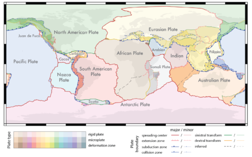
Modern plate tectonic framework showing how Turkana lies in a complicated “deformation zone” at the edge of the Somali Plate at present (Hasterok et al. 2022)
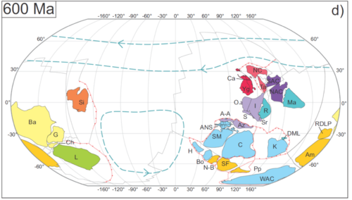
Plate tectonic reconstruction at 600 Ma. Turkana lies where ‘Az’ meets ‘C’. ‘Az is Azania and ‘C’ is the Congo Continent. India (I) is very close to colliding to form the East African orogen. Gondwana is forming around the blue, lilac, red and gold coloured continents (Collins et al. 2021). For an animation of a billion years of plate tectonics in 40 seconds, see https://www.youtube.com/watch?v=gQqQhZp4uG8
Far-fetched? It seems a bit doesn’t it. How can a mountain range govern biology and atmospheric chemistry? Let alone climate! Large mountain ranges are made of minerals—bundles of elements, if you will—that formed deep in the earth. They were stable there, but they are not stable on the earth’s surface. When they are thrust up into mountain ranges by plate tectonics, they react with water and carbon dioxide, locking up the latter in new minerals that form (and so by taking this greenhouse gas out of the atmosphere, cooling the earth), they also release elements into rivers and eventually oceans where they are available for life to use. These are nutrients such as selenium, copper and most importantly phosphorous (the framework element for DNA). Nutrient rich waters allow life to bloom and photosynthesize pumping oxygen into the atmosphere. Life on land, which would have likely been fungi, then seems to have started producing soils, smothering bare rock and limiting the cooling effect of new mineral weathering and helping regulate the planet’s thermostat.
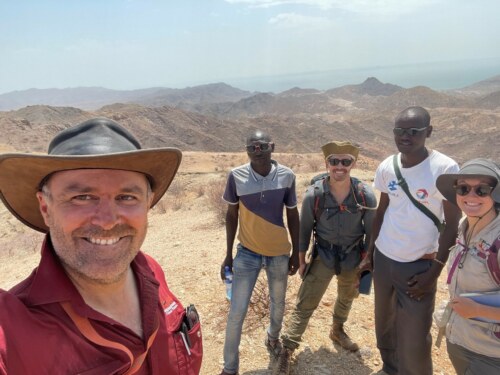
Alan Collins, Alex Aipa, Sam Boone, Frances Ekai and Morgan Blades on the top of the Lariu Range.
These are hypotheses; ideas that seem to fit what data we have. But that is the problem, we don’t have enough data and that is where the Turkana mountains come in. Rocks exposed around Loriu, Lokichar, Lokhone, Lodwar and Loima preserve Neoproterozoic basement rocks that have locked within them evidence for ancient volcanic island arcs, ancestral subduction zones and collisions between plates that made up deep-time Turkana. We just need to interrogate these rocks to get at this information by dating when they formed, by examining them in the field and by analysing their chemistry and mineralogy. When approached in this way, these rocks build a picture of 700 million year old ancestral Turkana looking a little like the modern South Pacific, with volcanic islands sticking out of the ocean overlying subduction zones where plates dive down beneath each other. Inevitably, at about 650 million years ago this idyll changed as a much older continent (now found in Somalia and central Madagascar, and named Azania) are thought to have collided with this subduction zone jamming it up, starting the process of mountain building and growing the core of Africa with its addition. If this wasn’t enough, about 70 million years after this, ancestral India (which included bits of South China and Antarctica) came ploughing in behind, in a similar manner to its present journey into Asia creating the Himalaya. Something to think about when you look out over the Turkwell river. The region was an ocean, dotted with chains of volcanic islands later caught up in the biggest mountain belt that we know about that may well have provided the conditions that made our planet habitable for large complex life.
We’ve told a story about really deep-time Turkana and how we aim to lift the veil on the secrets held within these rocks. But, these plate tectonic collisions may even control why The Rift is where it is, and why it is shaped like it is. The tumultuous events discussed above cause breaks that cut right through the crust and lithosphere. These are weaknesses, scars if you like, that stay in the fabric of the rock. Many people have postulated that The Rift has the shape that it has and is in Turkana exactly it’s location because of these weak zones and fabrics in the basement rocks caused by the huge forces imposed by these plate collisions. The basement tells a global story about why our planet is habitable, the structures within it guide us to why the ‘cradle of humanity’ formed where it did.
Written by: Prof Alan Collins, Dr Morgan Blades (University of Adelaide, Australia), Dr Samuel Boone (University of Melbourne, Australia)