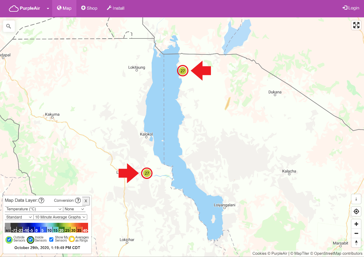
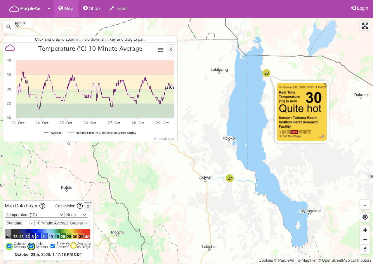
TURKANA BASIN WEATHER & AIR QUALITY MAP
During the second half of 2020, TBI installed two Purple Air sensors, one at TBI-Ileret and the other at TBI-Turkwel. These sensors measure smoke, dust, and other particulate air pollution, as well as keeping track of local temperature. By installing these sensors, TBI’s facilities will join an international, open-source air quality monitoring network facilitated by the Purple Air platform.
The sensors measure PM2.5 and PM10 – particulates of 2.5 and 10 micrometers or less respectively. The concentration of these particulates has implications for climate change and health, and is influenced by local factors such as localized combustion, as well as global trends in air quality.

By installing these sensors in remote regions, the data generated can act as a baseline for comparison of data in more built up areas of Kenya, which have more pollution from human activity.
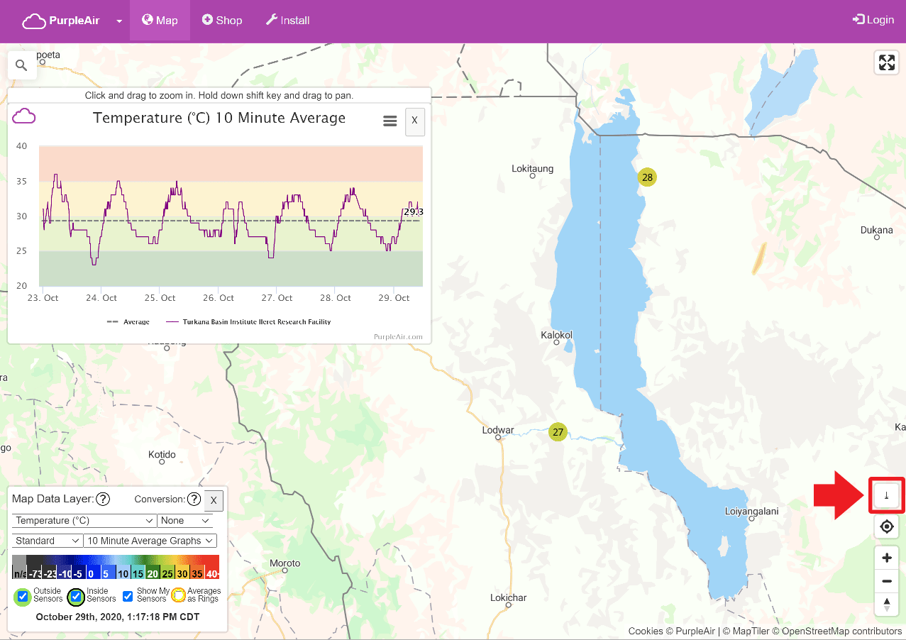
1. Using the PurpleAir sensor map
CLICK IMAGE FOR LARGER
CLICK IMAGE FOR LARGER
CLICK IMAGE FOR LARGER
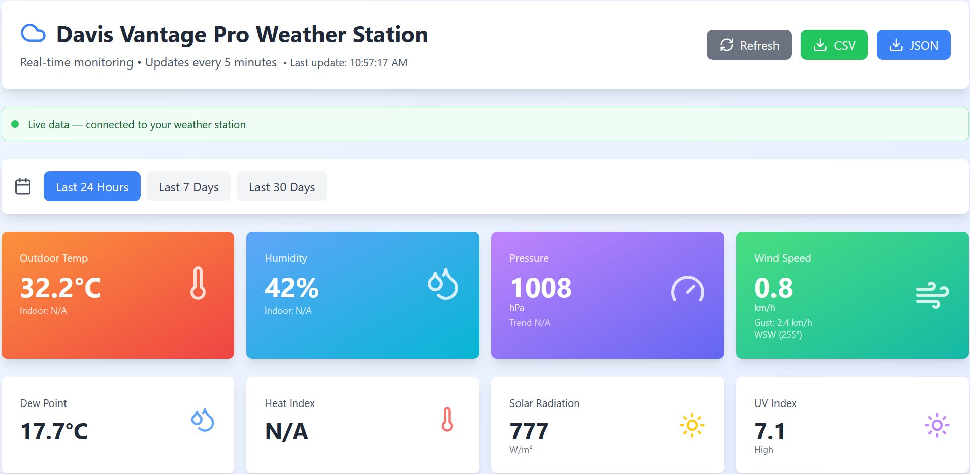
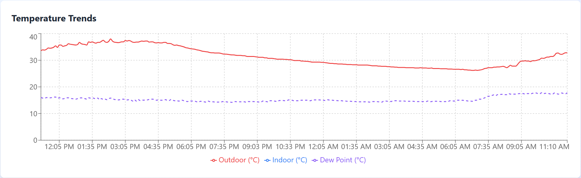
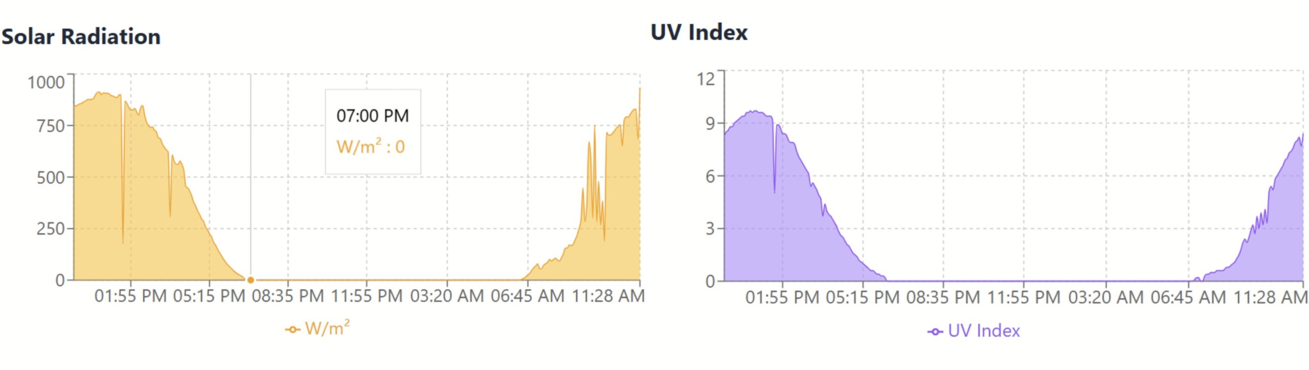
2. Using the Davis Vantage Pro Weather Station Dashboard – Ileret
SBU researchers Josie Aller and Kamazima Lwiza installed a Davis weather station at the Ileret campus in 2021. A donation of a meteobridge device (data logger) from DARA has now allowed the station to have capacity to stream live data. The station collects important meteorological parameters from one of the most extreme climatic regions. This data is now livestreamed and archived and is being used in the characterization of the Ileret site, for meteorological mapping, as well as for astronomical site testing. The data can be downloaded in both JSON and CSV.