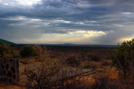
It might seem impossible, but one of the most important forces of nature changing the landscape in the Turkana Basin is water. The Turkana Basin environment is arid, but even today water moves sediments around, shaping the geology of the area. Many wet and dry cycles have impacted the Turkana Basin – both on annual and millennial scales. Water impacts life around the basin, but also the ground that this life inhabits. Water movement is key to understanding geological processes. Geologists observe such processes in the present to understand the past.
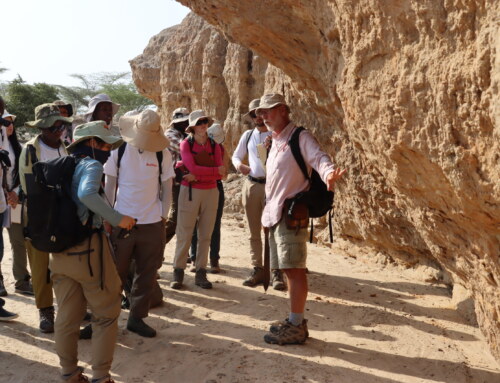
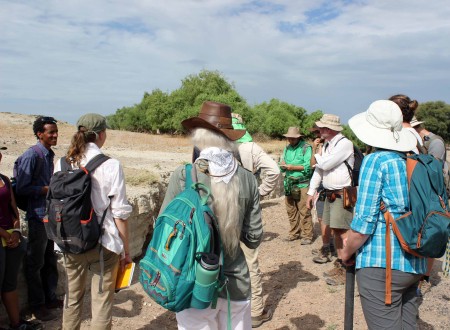
Prof. Feibel took the TBI students out into the field to observe modern water processes and their impact on the land. The first stop was a hike along the Tulu Bor river and delta. Since we are in the basin during the dry season, most rivers are now dry and easy to walk along. They are perfect examples of what sediments look like when they are shaped by flowing water. Before the hike, Prof. Feibel showed the students a map of the area so that they could see the course of the river and its outlet into the delta.
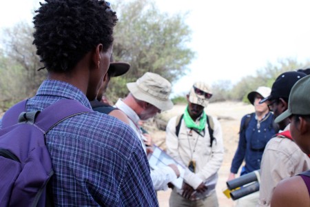
Prof. Feibel shows the TBI students a map of the Tulu Bor river and delta.
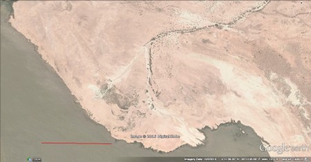
An image of the Tulu Bor river and delta system.
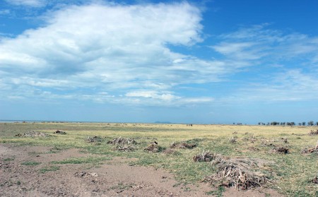
River systems are dominant markers in the Turkana Basin landscape, indicated obviously by large Acacia tortilis trees and many shrubs. These are in stark contrast to the dominant semi-desert environment with little vegetation. Large trees and dense bushes would be impossible in this landscape without the river systems. The water table beneath the laga is high and the roots of this vegetation reach down to find a good source of water to grow.
Most rivers in the Turkana Basin do not flow all year round. Instead, they remain dry until the rains come (usually twice a year in this part of the world) and the water accumulates in river catchment areas, flowing downstream. These systems can be fairly dramatic with flash flooding if the rains are heavy enough. Huge amounts of force impact the land when these waters flow, moving large amounts of sediments and rocks down from highlands and mountains, distributing them across the landscape. The geological formations of areas around river systems are drastically shaped by water in rivers. This is as true now as it was in the past.
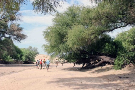
The stroll along the Tulu Bor laga was very pleasant with lots of shade from the giant Acacia tortilis trees.
Further, these havens of dense vegetation are completely dependent on the rivers. Rivers tend to meander over time, cutting new paths across the landscape. As rivers move across the landscape, vegetation around the old river path dies and new patches emerge following the river movement. These patterns show a distinctive record in the geology of the region over decades and millennia. River systems can complicate environmental signals from the past. One area may end up showing successive signals of more wooden, mosaic forest environments changing to more open, arid vegetation patterns. This may have nothing to do with changing climate, but more to do with a river meandering it’s way across a landscape. When reconstructing environments in the past, geologists and paleoenvironmental scientists have to take care to understand the specific systems that were in place on the landscape.
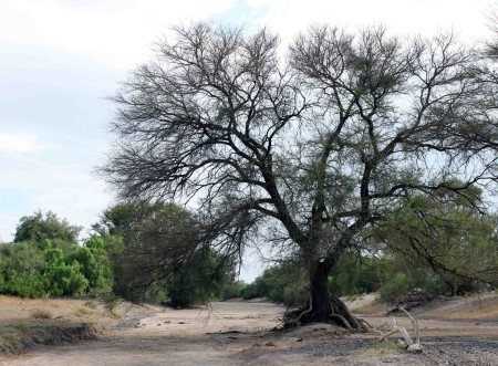
The high water table supports a larger amount of vegetation than you an observe on the rest of this arid landscape.
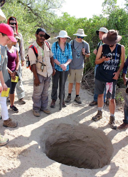
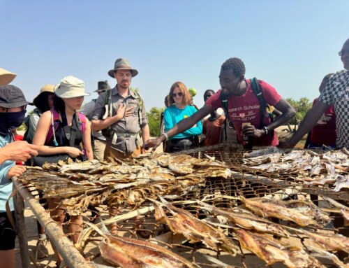
We stopped to look at a well along the laga (dried riverbed). Don’t be deceived, these dry riverbeds have a higher water table underneath them. Local people will collect their drinking water in these areas, digging holes by hand and collecting the water that fills them up.
We stopped to look at a well located in the middle of the laga. These dry riverbeds have a high water table underneath them. Local people will collect their drinking water in these areas, digging holes by hand and collecting the water that fills them up. The sediments act as a sort of filtration system, cleaning the water for consumption. This is one of the most common ways that people get their drinking water on this very dry landscape.
As we wandered down the meandering laga, we stopped to observe a deposit of volcanic ash called tuff. Scientists interested in the past use these volcanic ashes to acquire dates and build geological chronologies. The relative position of sediment layers to these tuff layers helps us create a timeline in the geological record. Rivers move rocks and sands and they also move ash after a volcanic eruption. This ash flows down the river and gets deposited on the landscape. This particular spot shows a thick mass of tuff deposit that formed layer by layer after successive flooding.
We looked at a section of Tulu Bor tuff deposits along the laga where water has cut through the ground, exposing the layers.
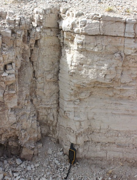
A thick section of volcanic ash (tuff) in the modern Tulu Bor river system.
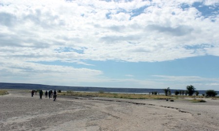
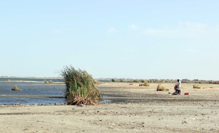
Continuing down the path of the laga, we began to observe wider more open spaces. We entered the delta at the end of the river where it flows into the lake. The fast flowing water that cuts through the ground upstream loses some force and spreads out over the landscape, eventually flooding into the lake. The vegetation changes to open grassy areas with few trees and bushes.
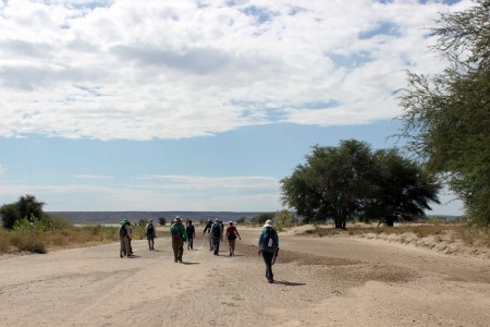
The students follow the laga of the Tulu Bor river and enter the delta.
The Tulu Bor river dumps water and loads of sediment on the shoreline of the lake. As it approaches the lake, it spreads out wide.
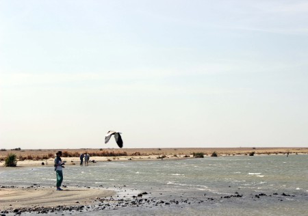
When lake levels rise, or when flooding occurs from the river systems during the wet season, this area can get soaked in water. Delta environments tend to be marshy, with many grasses and reeds, fewer trees and shrubs.
The grasses and reeds in the delta near the shore are drying in the hot sun during the dry season.
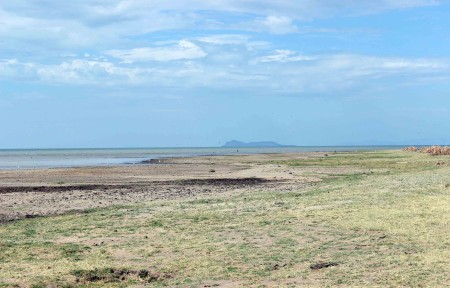
The view of North Island from the Tulu Bor delta shoreline.
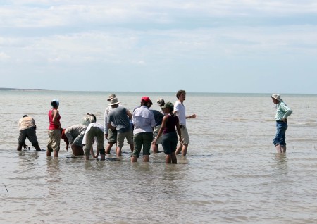
TBI students try their hands at taking sediment cores from the lake bottom with TBI field school director Linda Martin and Dr. Bob Raynolds.
Once at the shore, the TBI students set out to learn how to take a sediment core from the lake bottom. It’s not an easy task – you have to push the hollow pipe down into the lake bottom to trap the layers of sediments in sequence. Once you’ve worked hard to push it down, you have to pull it back up! The suction and stickiness of the sediments underwater make it difficult to pull out the tubes. On top of that, you have to be careful not to let the sediments fall out of the bottom. You have to place your hand on top of the tube to seal it and create suction so that the sediments remain in the tube as it is pulled out of the water.
These sediment cores provide a wealth of information for geologists to understand how sediments were deposited in the lake over time and they contain tiny bits of life that can speak to past environments (e.g., ostracods – creatures that look like tiny shrimp with shells).
The second major water system that shapes the geological formation of the Turkana Basin is the lake. The level of the lake has risen and fallen drastically over millennia, creating distinctive cycles of environments. There are moments in the past when the lake didn’t exist, and the land was dominated by river systems, and other times when the lake was much larger than today, being fed by a few key rivers.
We at TBI Ileret are fortunate to look out over the Lake Turkana on a daily basis as we eat every meal. This is the perfect setting to learn about how geologists study modern lake systems to understand those same systems in the past.
The view of the lake and North Island from the classroom veranda on a cloudy evening watching the sun set over Ileret.
Fluctuating lake level is a constant factor impacting the evolution of life, including our ancestors, in the Turkana Basin. Prof. Feibel took TBI students down to the lake shore to get hands-on practice with collecting shoreline elevation measurements.
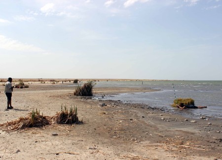
The dried reeds are remnants of when the lake levels were higher. You can tell how quickly the lake level is falling along this shoreline.
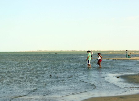
The students line up along the lakeshore, selecting spots for transects and collecting lake shore elevation data.
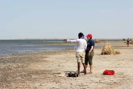
Yemane and Jen strategize which trajectory is best for their lake shore transect.
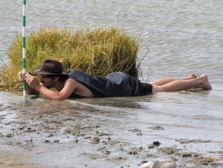
Adriadne and Max team up to collect their lake shore elevation data.
Tadele and Evan collect lake shore elevation data.
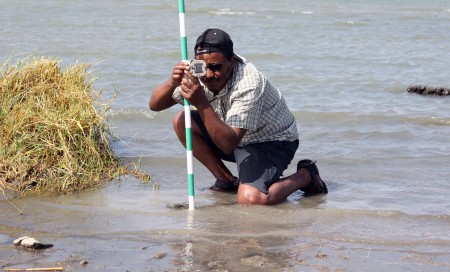
Tadele levels the jacobstaff with a brunton compass. This will provide one accurate data point to measure changes in elevation going from the shore into the water.
Getting geological data can be messy work. Evan gets down on the shore to level the jacobstaff with a Brunton compass (Photo credit: Prof. Craig Feibel).
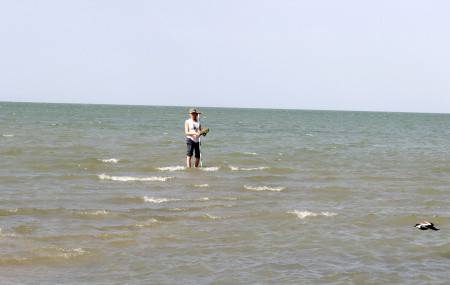
Milena wades out into the water to collect elevation data extending out into the shallow shoreline waters.
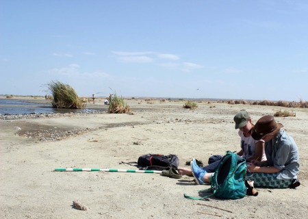
Milena and Kait draw up a rough sketch of their elevation measurements for their shoreline transect. Sketching in the field is a key skill to develop as it provides visual context for the list of measurements we collect.
Understanding modern lake shore dynamics is key to developing models of these systems in the past. We want to know more about lake margin settings in the past, as these environments have preserved rare fossil remains of life around the lake, including our ancestors and their tools. It is clear that the lake has attracted a lot of life throughout its history on earth, making lake system depositional environments key places for scientists of the past to collect their data.
Stay tuned for more about a mapping project of the Ileret area and our camping trip to Koobi Fora…