Throughout the history of the Turkana Basin, the dominant hydrographic systems that have fluctuated throughout the basin have been fluvial and lacustrine systems. While this fluctuating environment has been a main theme throughout most of the Geology module, students are now turning to studying current day environments to better understand sediment accumulation in past environments. While they just recently visited Lake Turkana’s shoreline, it was now time to examine a deltaic environment. During lacustrine stages in the basin, deltas form wherever a river meets a lake. Sediment accumulation is typically high at the delta due to sediment being supplied faster at the river mouth than it can be removed by lake processes.
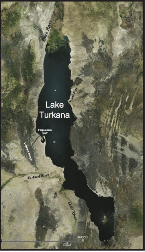
Map of Lake Turkana and the surrounding area. Ileret is slightly of the Koobi Fora area.
For this lesson, we focused on deltaic environments and different methodologies to study the sedimentary processes that are occurring in modern day environments. Deltas are very important in the Turkana Basin because there have been many important fossils preserved in paleo-deltaic deposits. In the Koobi Fora and Ileret regions in which we are predominately working, deposits from the Omo river delta can be found that date from the Pliocene-Pleistocene.
The Ileret region is, as the crow flies, rather close to the Omo river delta, but reaching this area would involve taking boats and is mostly presently located within Ethiopia. Due to limited time, the students had to look for the answers at another nearby delta that would preserve similar processes as the Omo river delta. Fortunately, we have our very own delta where the Ileret river empties into Lake Turkana! Although not as large as the Omo, it was close and just as informative. The Ileret river delta is particularly interesting because it is an ephemeral system. As such, it typically flows only during the rainy season; but when it does, it is a rather high energy braided river, and thus moves great amounts of sediments.
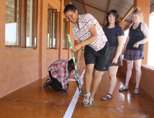
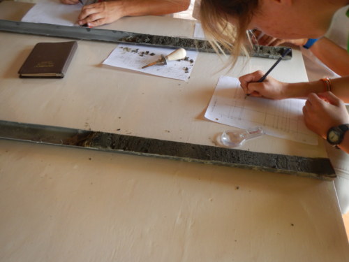
For our field practical, we obtained sediment cores. Coring is a method used very often in geology to obtain samples of sediments and/or rocks in an area. Though we would only be using four foot long PVC pipes to take our samples, in other areas and studies, cores can be absolutely massive, such as those used in mid-oceanic drilling and sampling.
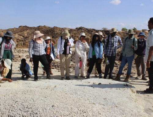
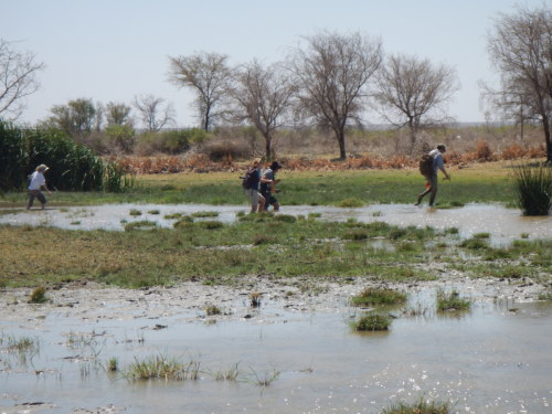
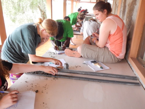
The students were divided into three groups: each group would be taking a core in a different area of the delta, with each area being indicative of different influential processes. Two would be taken in the delta plain, which is closer to the river channel and is typified by more vegetation, and one at the delta front, which experiences more wave action from the lake.
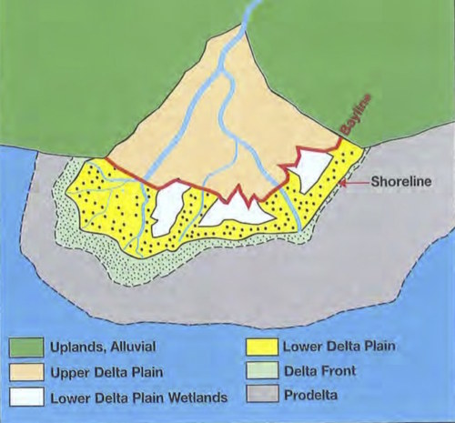
Diagram outlining a deltaic environment: note the delta plain and delta front, where the students took core samples.
To take an accurate core, you are trying to push the core as deep into the sample area as possible while still being able to remove it (oftentimes this is easier said than done!). Once the core has reached a sufficient depth, it must be sealed: we used a fitting cap which was also duct taped around the PVC to ensure an airtight seal. Sealing the top of the core creates suction that should hold in the majority of the sample inside the core as you remove the core from the ground. Further, as soon as the bottom of the core exits the ground, you should seal the bottom (either with a hand, cap, or other method).
Professor Martin points this group in the right direction to core along the delta front area.
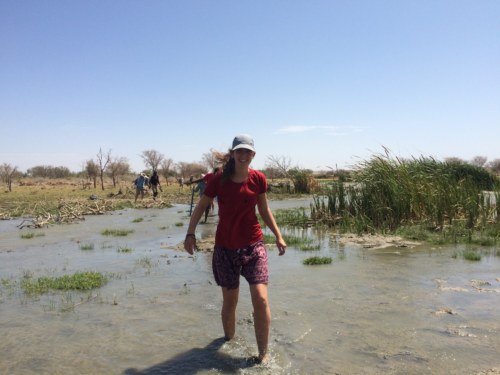
Millie journeys across the marsh, careful not to fall into the mud!
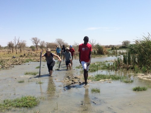
The students creatively used their cores as walking sticks to balance through the muddy terrain!
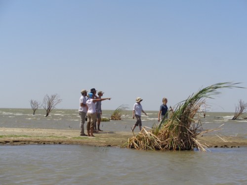
This group fords the delta to reach their sampling area.
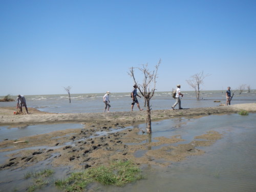
Contrast between delta plain and delta front. In the foreground, we can see the delta plain with more vegetation, as compared to the delta front on the sandbar, where the lake meets directly with the delta.
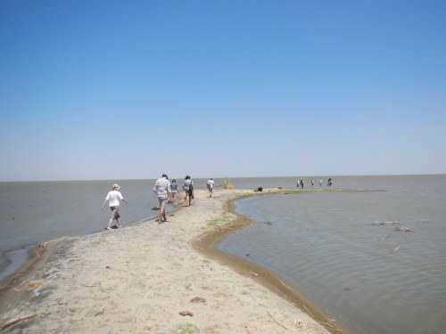
This group walks along the sandbar to get to another area of the delta front.
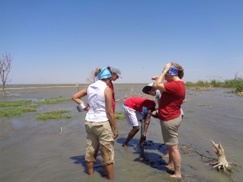
Professor Martin discusses with this group how to get the core started.
This group works to embed their core through the sticky clay bottom.
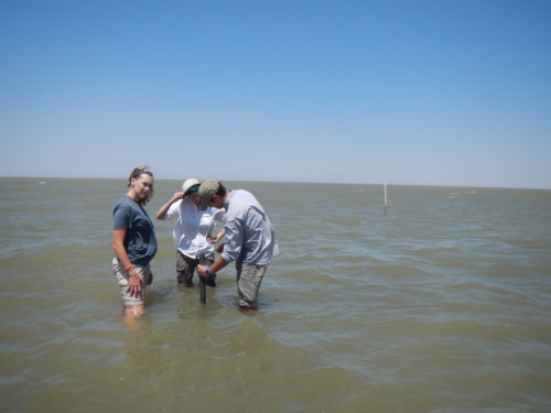
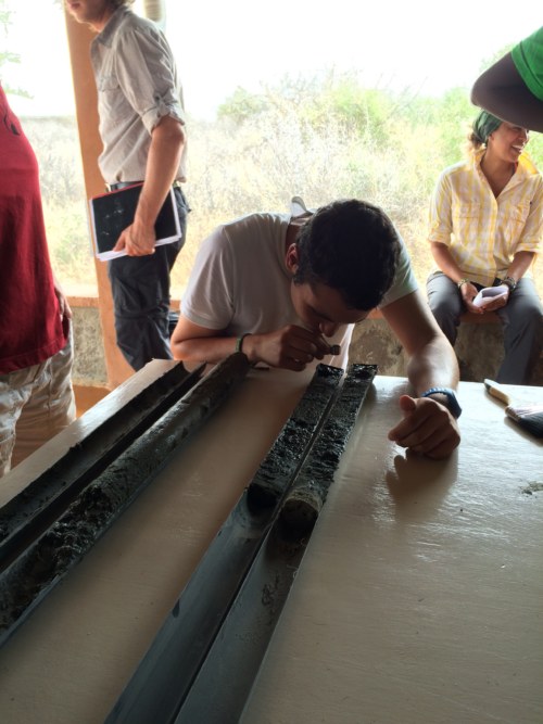
Removing the core after forcing it a few feet into a claylike lake and delta bottom is much more difficult than can be imagined! The surrounding clay suctions to the PVC pipe. Teamwork was very important in successfully removing these cores!
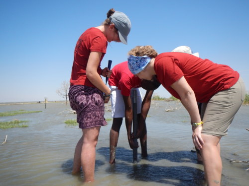
This group struggles to free their core from the clutches of the earth!
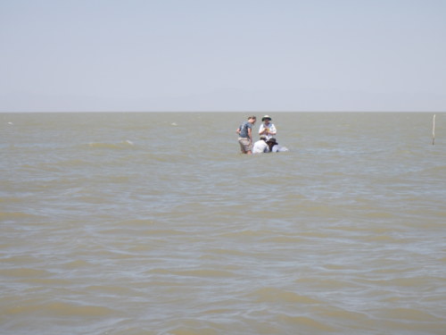
In the delta front, Jon and Max submerge themselves to get a better grip on their core!
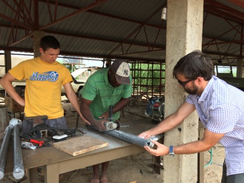
Once the cores were removed and appropriately sealed, they were frozen immediately after returning to TBI-Ileret. This is done to better solidify the sediments and keep them accurately intact when the cores are split open. The cores were split open using a grinder, wielded by our ever helpful driver and mechanic, Mwan’gombe. He was very careful just to split the PVC pipe and not the sediments inside!
Mwan’gombe splits the core while Dr. Henkes and Mattia stabilize it.
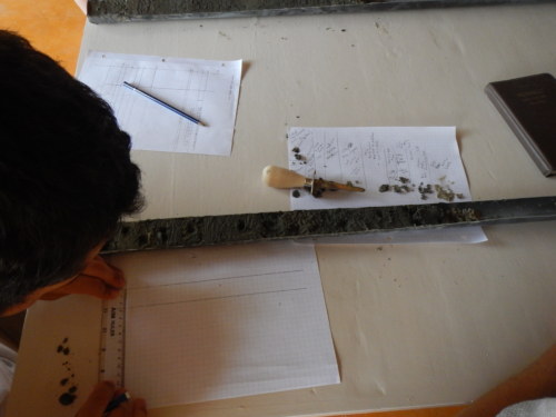
Once the core is split open, the students can then analyze what they see inside, and compare across cores what each group found. This practical is especially fun and interesting because it is almost an exact replica of a very important method used by geologists around the world!
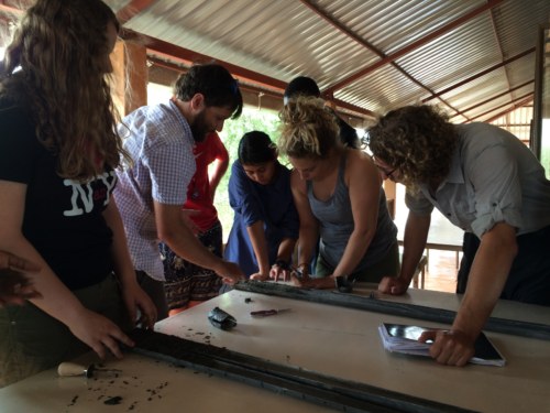
Dr. Henkes explains how to accurately analyze a core sample.
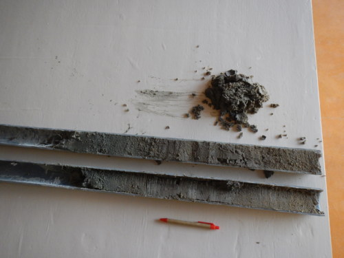
One group’s final product; the pen adjacent is used for scale.
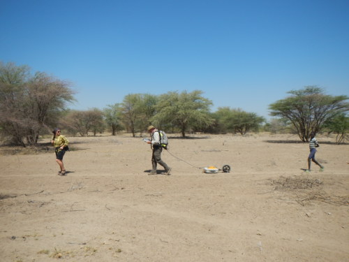
While at the delta, visiting geologist Dr. Davis was experimenting with research of his own! Because this was his first time in the area, Dr. Davis had brought his GPR (Ground Penetrating Radar) equipment with him to conduct preliminary data inquiries. He was not quite sure what he would find but was interested in what this area may have to offer!
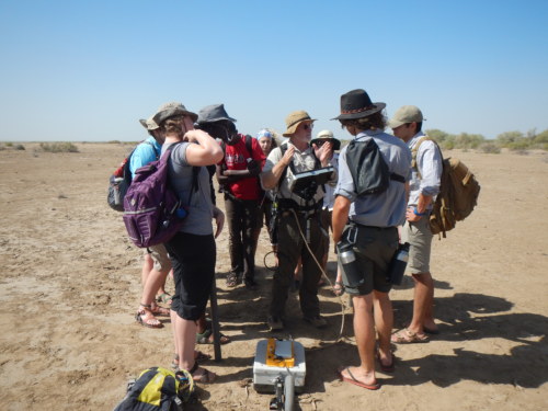
Dr. Davis describes the GPR to the students.
GPR uses radar to detect changes in underlying sediment: for example, if there is a large uniform sandstone bed, the radio waves rebound with a uniform signal. However, if there was a large fossilized femur (or other sufficiently large object) in the middle of the bed, the waves would rebound with different characteristics off of the fossil than the surrounding sediment!
Jayde, Dr. Davis, and a local Dasanach boy walk along the laga (dry riverbed) toward the delta.
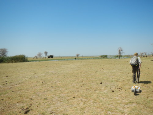
Dr. Davis along the final stretch to the lake.
Further, it was very interesting to see a geologist conduct research with high-tech equipment. This experience really brought to light the unique nature of this field school—we are not just learning about this material in a classroom, but rather learning about it as we encounter it in the field. The Earth itself is the best geology textbook!